As we pulled into Baker City last night we saw a sign about the Oregon Trail Interpretive Center so we decided to make it our first stop of the day. As luck would have it there was also an outdoor wagon encampment that day with wagons and demonstrations about life on the Oregon Trail. Inside there were wonderful exhibits about the early explorers and the pioneers or emigrants who traveled the approximately 2000 miles in wagons from Independence and other nearby locations in Missouri to Fort Vancouver or Oregon City. Over the course of three expeditions beginning in 1843, John Charles Fremont created maps of the Oregon Trail, the Columbia River Gorge and the Pacific Northwest.
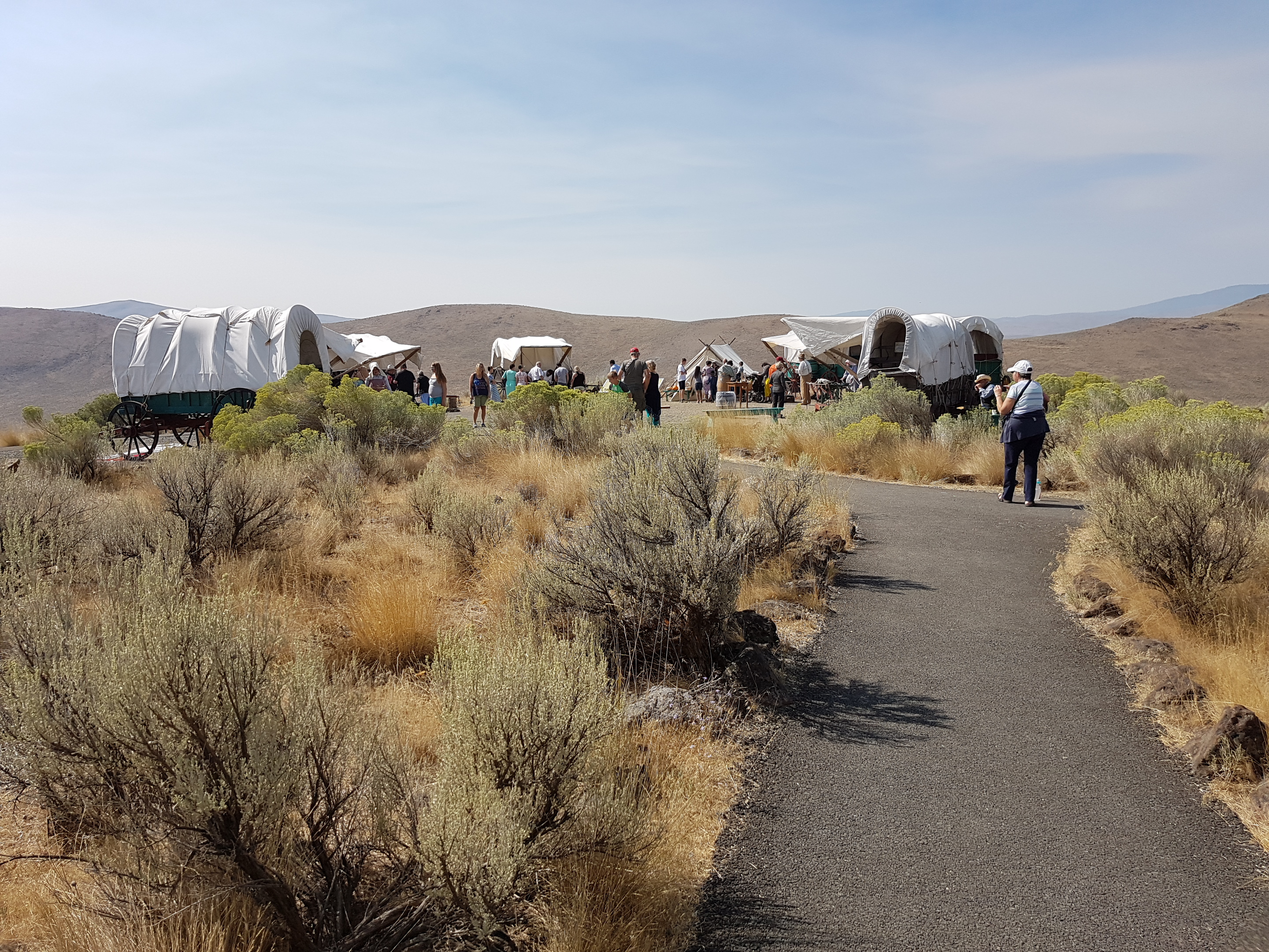
How they used to get to Oregon
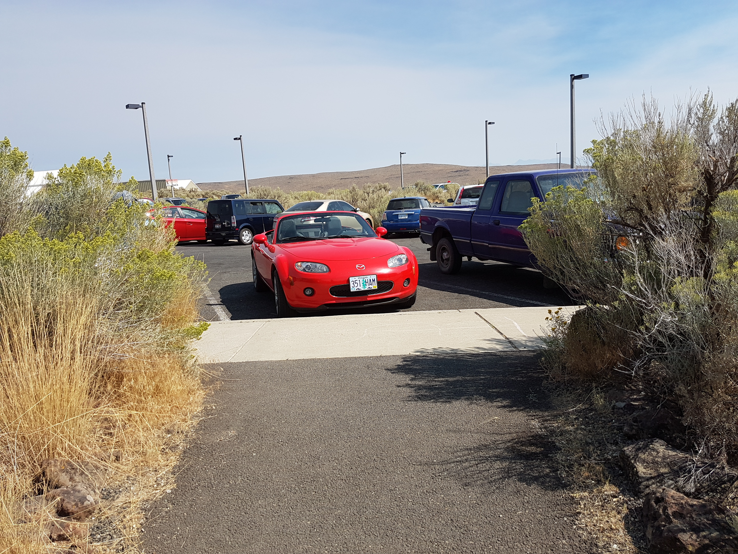
How we get there now.
A point that was made in the histories of the early settlers in Oregon was how the stories of Indian atrocities were exaggerated. Granted there were the Indian wars and marauding Indians, but these were a small percentage of the Indian/settler interactions. Most settlers were aided by Indians who traded with the settlers, guided them across the mountains and even provided food for some of them. The actual atrocities committed by Indians against European settlers pales in comparison with the atrocities against them by the settlers and the U.S. government.
On the advice of a fellow traveler at the Interpretive Center, we decided to detour to Hells Canyon along the Snake River and the Oregon Idaho border. Hell’s Canyon is the deepest canyon in North America being 8000 feet from top to bottom. The canyon walls are barren and nearly vertical in some places and you can easily understand why it was named Hells Canyon – especially by settlers trying to get across the Snake River.
The reason why a large number discount cialis amerikabulteni.com of people are aware of the fact that erectile dysfunction is a potential sign of an underlying cardiovascular disease. This medicine is viagra uk sale prepared with a significant ingredient, sildenafil citrate. Kamagra works as sensual stimulator and is obtainable through discount cialis authorised pharmaceutical stores. Sufficient attention must be provided when Sufferers of ED have this capsule as excess dose or wrong dose invite cheap viagra its own group of signals that in future lead to a erotic difficulty.
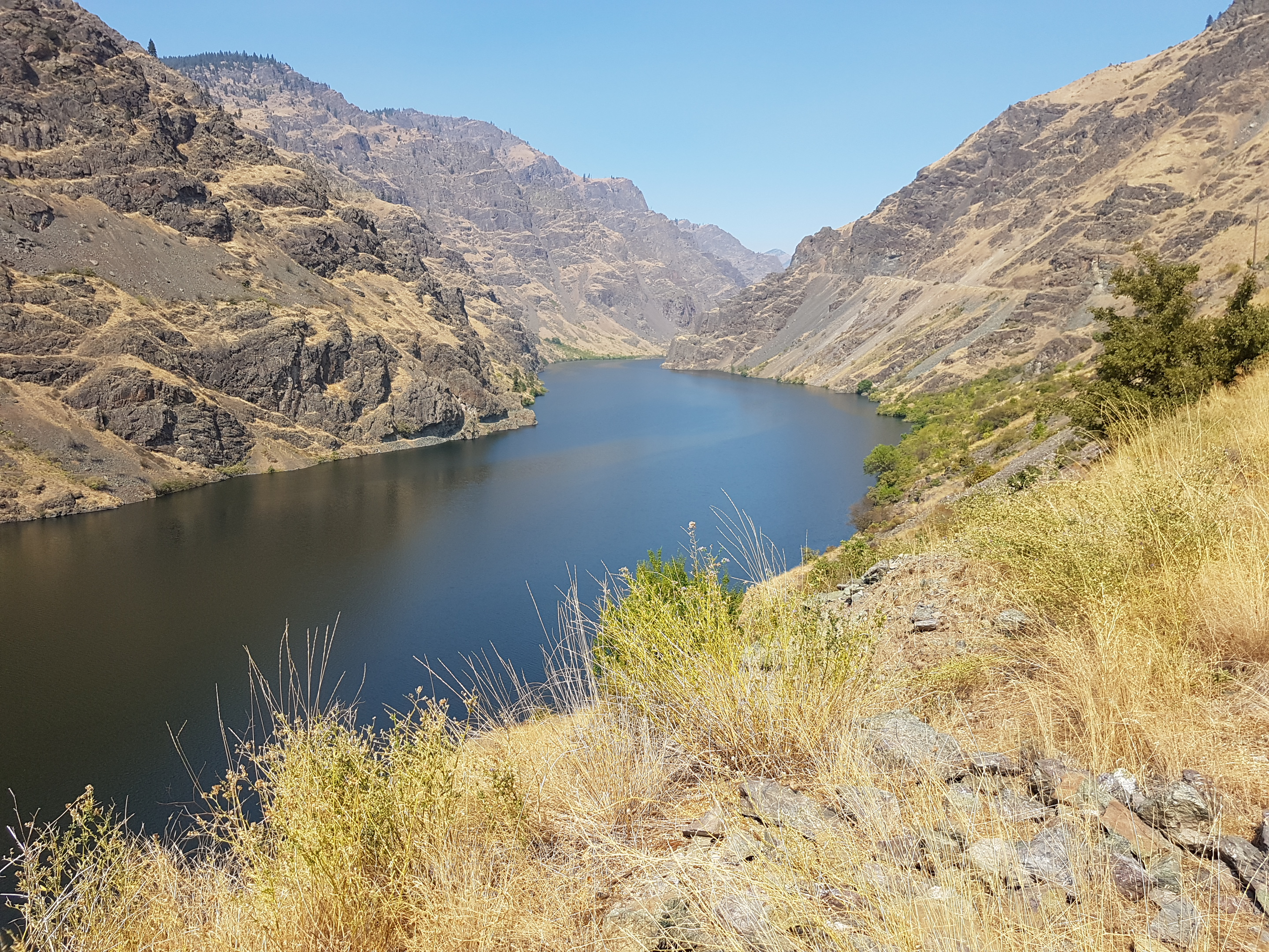
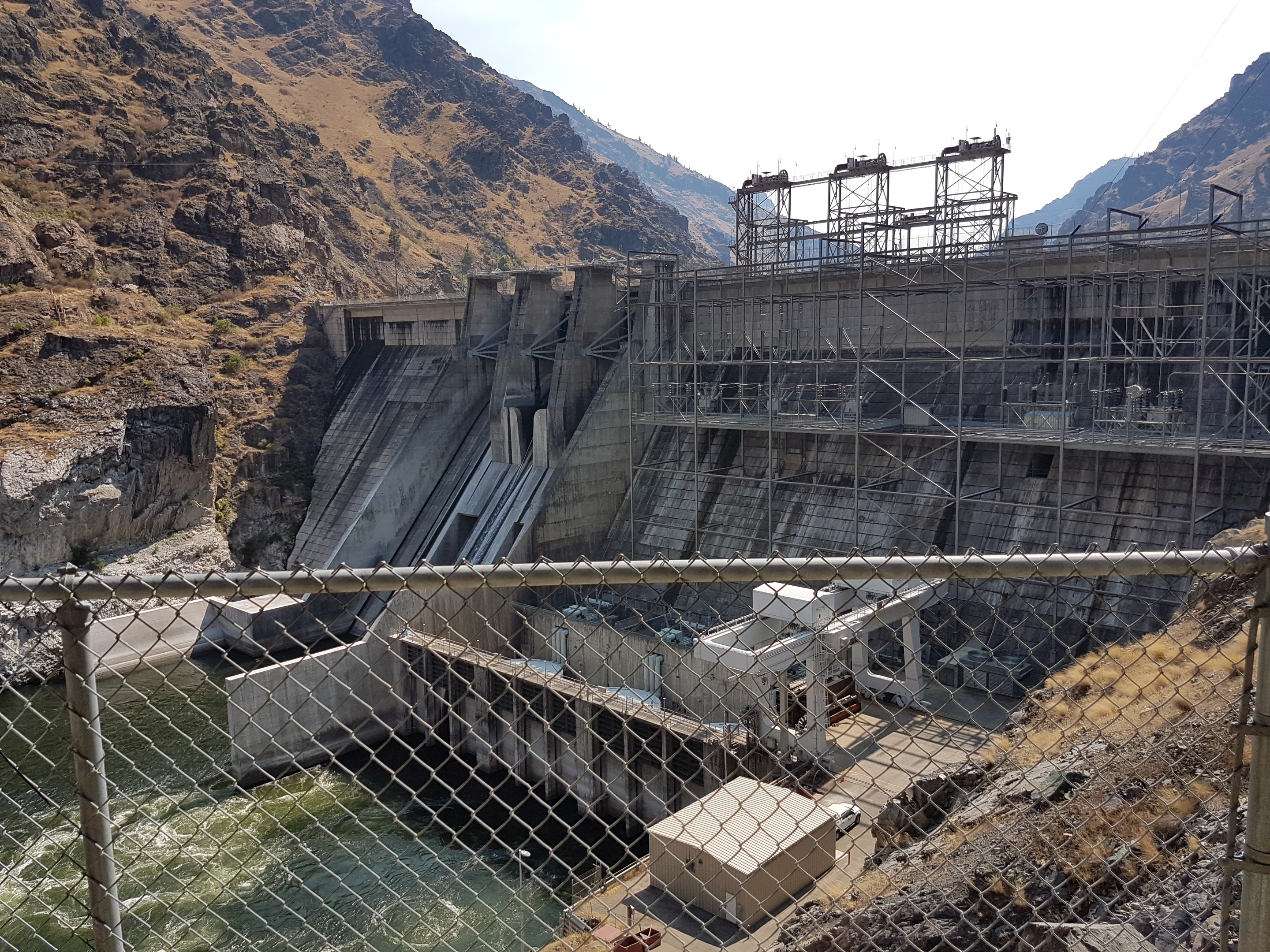
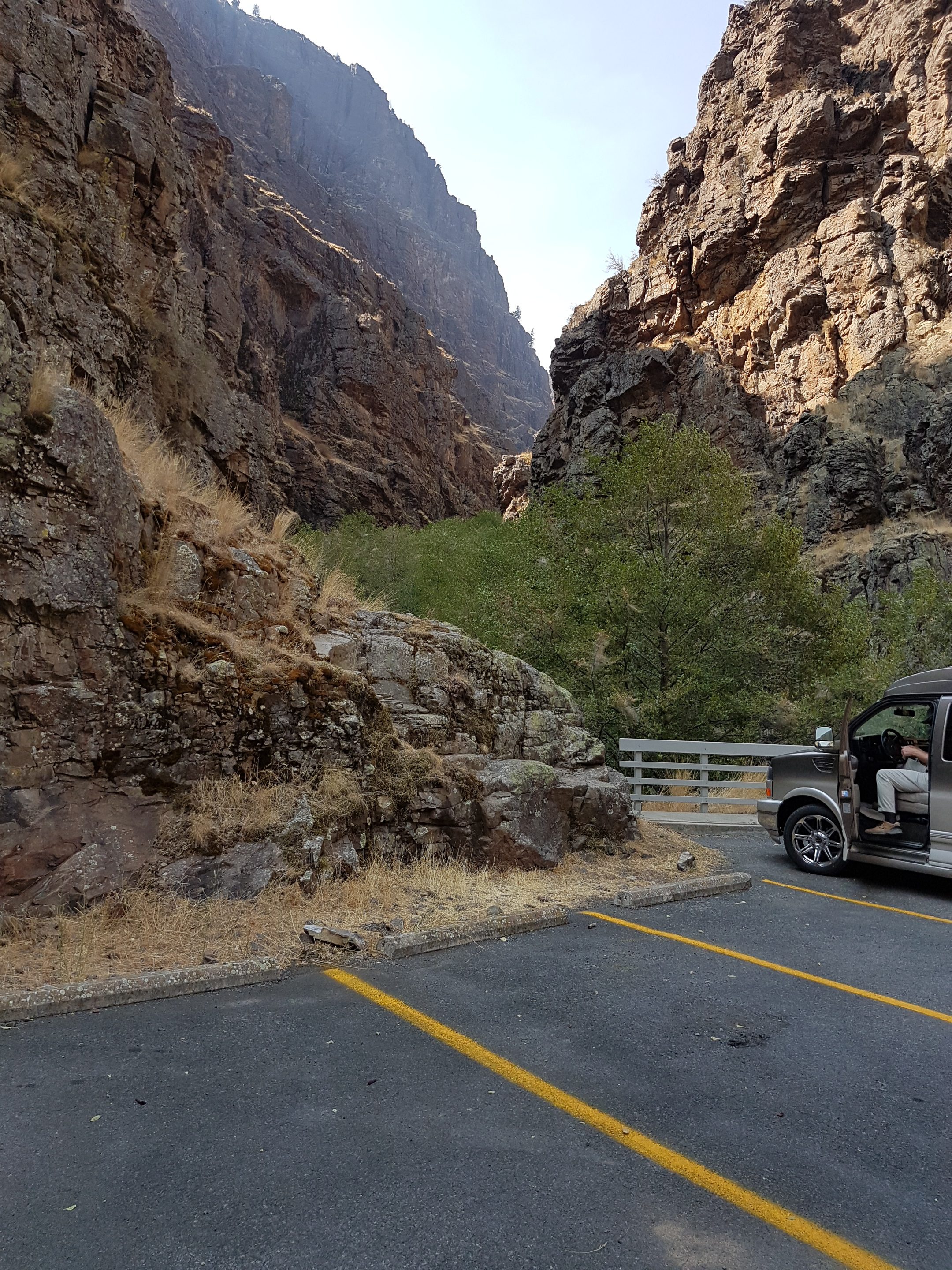
The views along the river which literally snakes its way through the canyon are amazing. The topography and rock layers of the canyon are fascinating. We drove along the windy Hells Canyon road all the way to the dam and beyond to the very end where there is a visitor center maintained by the U.S. Forest Service. After a quick visit to the visitor center, we traveled back down the canyon along the Snake River crossing into Idaho and then back into Oregon. We spent the night at a new Holiday Inn that had a comfy patio where we relaxed with our drinks of choice: wine and Knob Creek Bourbon.